

Smart irrigation is gaining attention
Water is becoming scarcer, climate conditions are becoming more unpredictable, and the pressure to produce sustainably is increasing. Growers are therefore actively looking for solutions that help them irrigate more efficiently. The question often arises: which technology offers the most reliable support?
Some growers start with soil moisture sensors. Others use satellite imagery. More and more are discovering that the real power lies in combining both, supported by AI.
Sensors: certainty in the root zone
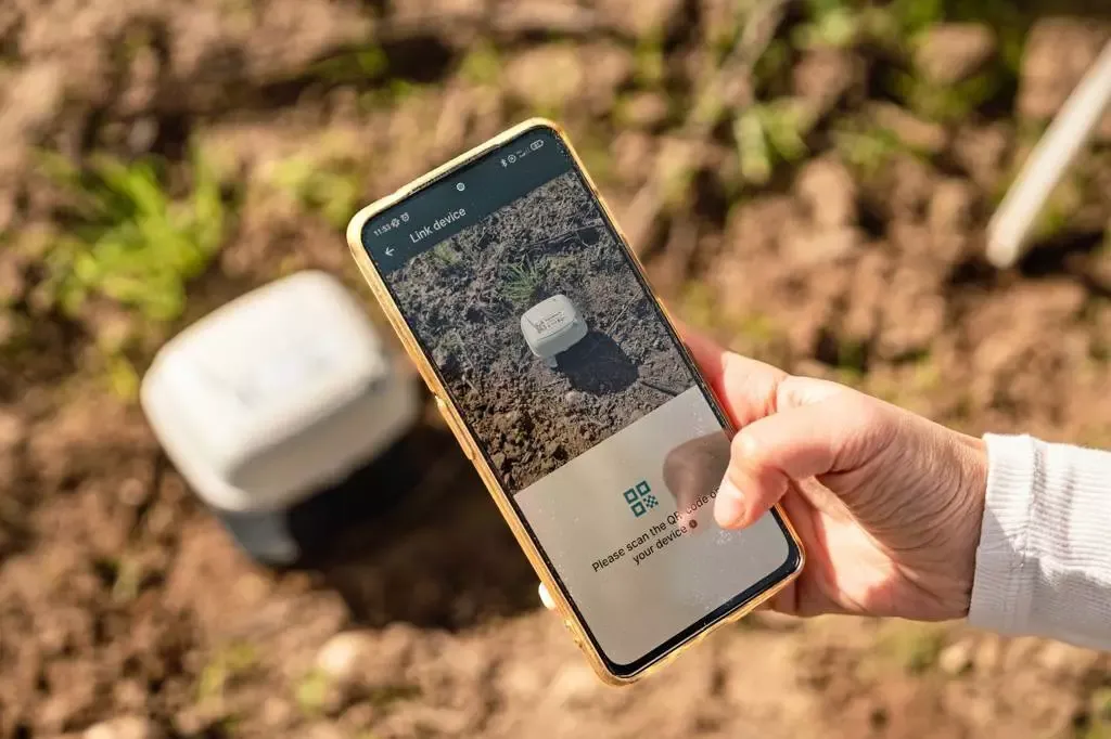
Soil moisture sensors provide direct measurements in the root zone, where water and nutrients are actually absorbed by the plant. They continuously measure soil moisture, EC, and temperature and provide reliable insights 24/7.
At the same time, growers ask logical questions: how many sensors do I need per plot? Where should I place them? A sensor measures locally, and growers want to be sure that one measurement is representative of the entire field.
Satellites: overview and scale
That is why many companies also use satellites. NDVI and other indices provide a direct picture of crop development and where variation occurs. The big advantage is that huge areas can be monitored at once, often with affordable or even free data.
The limitation is that satellites view from above. They provide an approximation of soil moisture and crop development, but never measure directly in the root zone. The resolution is approximately 10×10 meters per pixel, and they are dependent on clear weather.
The reality in the field
Growers often know their own plots well. On homogeneous soil, a single sensor can be representative. But many growers also work with leased land or plots with natural variations in soil type and moisture. In those cases, additional support is welcome.
With the rise of drip irrigation, the need for variable irrigation is also increasing. Installing a sensor in each irrigation block can quickly become too expensive. Growers are therefore looking for ways to combine technologies in a reliable and affordable way.
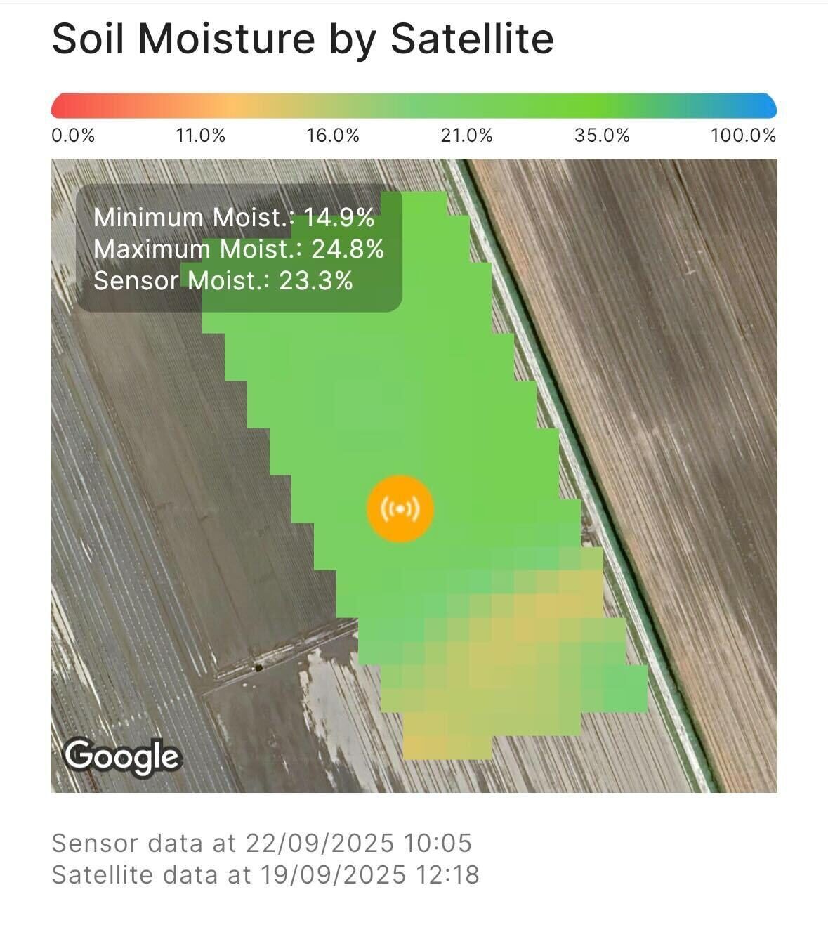
Practical example from the Netherlands
After the introduction of our combined solution with sensors and satellite-based field maps, one of our customers in the Netherlands—a grower who already knew his plot well—confirmed something he had already suspected. A specific part of his plot consistently lagged behind in yield. With Agurotech's solution, he saw that this area also showed systematically lower soil moisture values, even after heavy rainfall. This insight made it clear that moisture stress was the cause of the lower yield and gave him a concrete starting point for taking action.
The power of combination
The solution is not to choose between sensors or satellites, but to combine their strengths and connect them via AI.
- Sensors provide reference measurements with accurate, continuous measurements in the root zone.
- Satellites provide context with a broad overview of variations within and between plots.
- AI brings the data together by linking sensor measurements to satellite images and weather forecasts, creating models that are both accurate and scalable.
The result is practical advice that growers can apply immediately, from a 10-day irrigation plan to the precise adjustment of drip irrigation.
Why this accelerates adoption
By complementing each other, sensors and satellites make the transition to smart irrigation easier and more attractive. Growers no longer have to choose between detail and overview—they get both.
This approach lowers the barrier to entry, as growers can start small with a few sensors and supplement them with satellite data. It also increases confidence, as sensor data confirms what satellites show and vice versa. And it is scalable, as the investment can grow from a single plot to an entire farm.
Conclusion
Agriculture is entering a new phase. Growers are showing increasing interest in data-driven irrigation, and the questions they are asking are logical and valuable. They are helping to improve the technology and make it more widely applicable.
The future lies not in choosing between sensors or satellites, but in combining them. Sensors provide certainty, satellites provide overview, and AI translates this into action. This creates an irrigation strategy that is both reliable and scalable—exactly what growers need to invest in the future with confidence.
Would you like to see how the combination of sensors, satellites, and AI can work for your business? Discover Agurotech's solutions or contact us for more information.
.jpg&w=3840&q=75)


